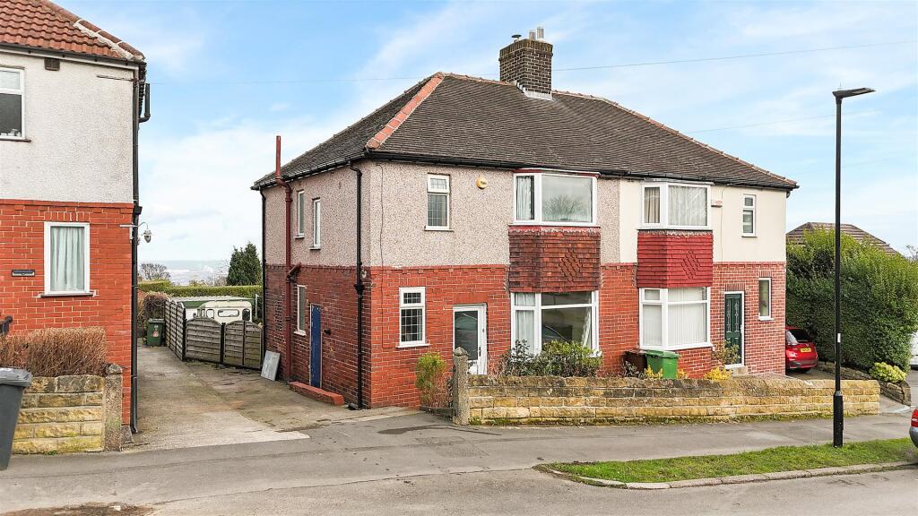
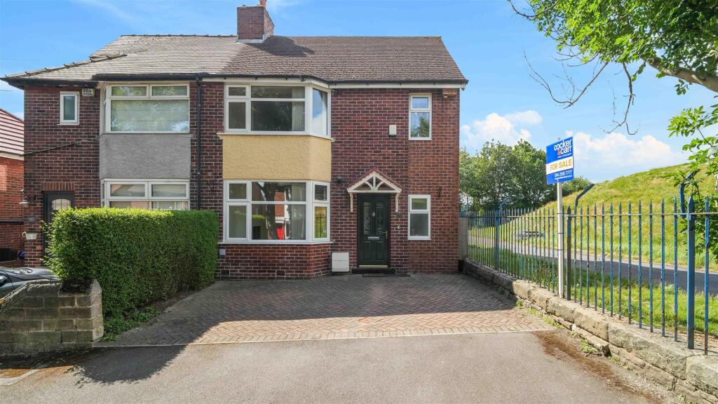
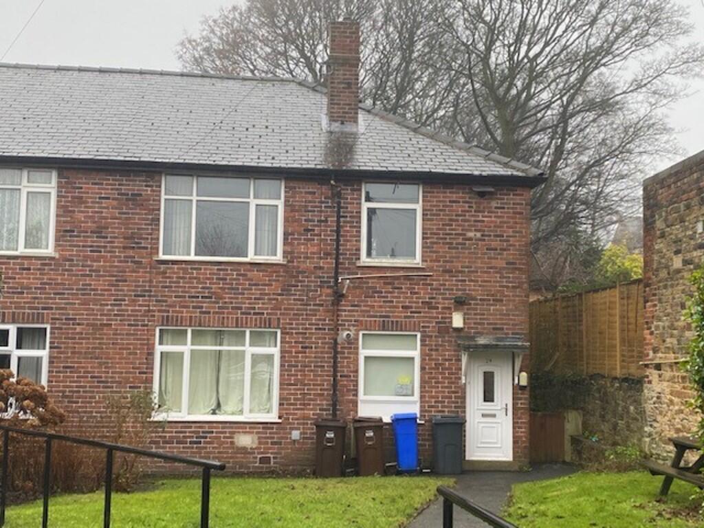
Property Information Report
21 Ryegate Crescent
Sheffield, S10 5FD
Estimated Value - £395,000
Estimated Rental Value - £1,175 PCM
Last Sold - Jun, 2015

Key Facts
About Us

Tempted?
Let us know what price would make you sell and we will let you know when a buyer comes forward at the right price - no public marketing needed.
Generate a full report on your own property including an instant estimated valuation.
Title Plan
 Contains OS data © Crown copyright 2025
Title Information
Details provided by the Land Registry
- Title Number
- SYK257792
- Plot Size
- 0.06 acres (257 sq metres)
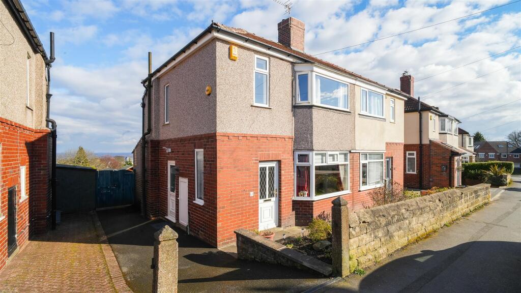
Street View
House Prices in Sheffield
Last 12 months
-
Average Price Change
£208,861
Decreased by 100%
-
Semi-Detached Price Change
£225,284
Decreased by 100%
Average House Prices
Last 12 months for all property types.
Since - June 2020
-
Average Price Change
£158,745
Decreased by 100%
-
Semi-Detached Price Change
£171,022
Decreased by 100%
Average House Prices
Since 2020 for all property types
EPC

EPC Information
Details taken from the EPC register
- Date
- 2015-03-30
- Valid Until
- 2025-03-29
- Energy Efficiency - Current
- 71
- Energy Efficiency - Potential
- 82
- Environmental Impact - Current
- 67
- Environmental Impact - Potential
- 78
Properties For Sale in the Area
Ryegate Crescent
17 metres away
Ryegate Crescent
31 metres away
Ryegate Road
62 metres away
Evelyn Road
68 metres away
Evelyn Road
0.11 km away
Evelyn Road
0.12 km away
Properties To Let in the Area
Evelyn Road
0.11 km away
Evelyn Road
0.11 km away
Bosville Road
0.18 km away
Lydgate Lane
0.23 km away
Apt 6 Kennedy Court
0.24 km away
Tapton Bank
0.27 km away
Schools
| Name | Type | Postcode | Distance | Rating |
|---|---|---|---|---|
| Lydgate Infant School | Primary | S10 5FQ | 0.17 km | Good |
| Lydgate Junior School | Primary | S10 5DP | 0.39 km | Good |
| Birkdale School | Independent, Primary, Post 16 | S10 3DH | 0.70 km | Not rated |
| St Marie's School, A Catholic Voluntary Academy | Primary | S10 3DQ | 0.71 km | Good |
| Notre Dame High School | Secondary, Post 16 | S10 3BT | 0.82 km | Good |
Transport
Bus Stops & Stations
Details provided by Department for Transport
| Name | Distance |
|---|---|
| Manchester Road/Vernon Terrace, Manchester Road | 0.32 km |
| Manchester Road/Tapton House Road | 0.34 km |
| Crookes/Bute Street | 0.45 km |
| Crookes/School Road | 0.49 km |
| Fulwood Road/Endcliffe Crescent, Fulwood Road | 0.52 km |
Train Stations
Details provided by Department for Transport
| Name | Distance |
|---|---|
| Sheffield Rail Station | 3.21 km |
Nearest Motorway
Details provided by Department for Transport
| Name | Distance |
|---|---|
| M1 | 8.26 km |
Coverage
- Average Broadband Speed:
-
16mb Basic
-
80mb Superfast
-
1800mb Ultrafast
-
1800mb Overall
- Mobile Coverage:
-
EEGood
-
O2Good
-
ThreeOkay
-
VodafoneOkay

Recently Sold Properties in the Area
| Address | Property Type | Distance | Price | Completed |
|---|---|---|---|---|
|
16 Ryegate Crescent Sheffield, S10 5FD |
Semi-Detached | 30 metres away | £413,500 | 6 months ago |
|
137 Lydgate Lane Sheffield, S10 5FN |
Terraced | 0.13 km away | £215,000 | 8 months ago |
|
40 Evelyn Road Sheffield, S10 5FF |
Terraced | 0.13 km away | £309,000 | 9 months ago |
|
131 Lydgate Lane Sheffield, S10 5FN |
Terraced | 0.14 km away | £260,000 | 8 months ago |
|
113 Lydgate Lane Sheffield, S10 5FN |
Terraced | 0.15 km away | £279,500 | 7 months ago |
|
Apartment 2, The Grange 96a, Tapton Crescent Road Sheffield, S10 5DW |
Flats/Maisonettes | 0.16 km away | £235,000 | 8 months ago |
|
109 Lydgate Lane Sheffield, S10 5FN |
Terraced | 0.16 km away | £273,000 | 3 months ago |
|
5 Hallgate Road Sheffield, S10 5GL |
Semi-Detached | 0.16 km away | £450,000 | 8 months ago |
|
Apartment 9, Laurel House 96b, Tapton Crescent Road Sheffield, S10 5DY |
Flats/Maisonettes | 0.16 km away | £246,000 | 9 months ago |
|
Apartment 7, Anne McNamara House, 152 Lydgate Lane Sheffield, S10 5FP |
Flats/Maisonettes | 0.17 km away | £205,000 | 10 months ago |
Important Notice - This report is intended for general informational purposes only and should act only as a guide. The report is produced automatically on behalf of Redbrik - Redbrik by Street Insights, a product of Street Systems Ltd. Street Systems maintains and aggregates data from multiple public data sources and whilst every effort is made to keep information up to date and accurate, we make no representations or warranties of any kind about the accuracy, reliability or completeness of the information contained within this report for any purpose. Any reliance you place on the data contained within this report is strictly at your own risk. In no event will Redbrik - Redbrik or Street Systems Ltd be liable for any loss or damage including without limitation, indirect or consequential loss or damage, or any loss or damage whatsoever arising from loss of data or profits arising out of, or in connection with, the use of this report.
This report contains public sector information licensed under the Open Government License v3.0
Transaction data and HPI data is produced by HM Land Registry. Crown copyright and database rights 2025